As you travel across the White Pass Scenic Byway, the changing landscapes capture the eye. Following two river valleys winding between volcanic giants, this journey is a story of mountains and rivers, the habitats they create, and the outstanding recreation opportunities they offer.

Salkum Plateau

Small-scale agriculture, rural residential communities, and rolling hills are typical of the west end of the byway. Views of all three of the corridor’s volcanoes can be seen from this section of roadway—the only place on the byway where all three mountains can be seen at once. View the Cowlitz River, a powerhouse along the Byway. Along with several hydroelectric dams forming great lakes, it is also a year-round fisher’s paradise and home to the best steelhead fishing in the state. A short side-trip from the byway takes visitors to Cowlitz River salmon and trout hatcheries. The Cowlitz salmon hatchery is the largest in Washington State, and has a very good self-guided tour through the facility. Lewis and Clark State Park has easy access to a protected stand of old growth forest habitat, and also includes one of the corridor’s most significant historic buildings, the 1850 John R. Jackson courthouse.

Lakes District

The Lakes District includes one of the most dramatic driving moments on the corridor – turning the corner to the Mayfield Lake causeway, with the clear water of the lake surrounding the road and the green backdrop of the forested shoreline. Recreation facilities on Mayfield and Riffe Lakes are some of the busiest in the corridor, including camping, fishing, wildlife watching, and hiking. Approaching Mossyrock, the display gardens and flower fields of DeGoede’s Bulb Farm & Gardens are a major seasonal destination in the springtime, but offer something for visitors to see throughout the growing season. The community of Mossyrock provides small-town character and services for visitors.

Big Bottom Valley

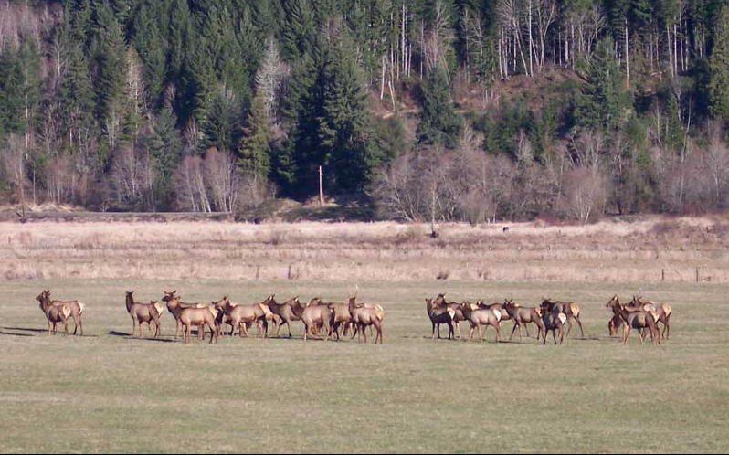
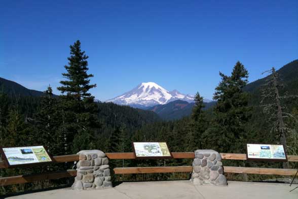
As you head east out of Morton, the highway swings south again to link with roads that access the upper end of Riffe Lake and the Cowlitz River Valley. The broad lowland floodplain is surrounded by forested foothills, with occasional views of the big volcanoes. This district includes several more lakeside parks with boating, camping, and fishing. Randle, the largest community in the district, is the turning-off point for the Mount St. Helens National Volcanic Monument and Columbia River Gorge. The valley bottom is prime elk habitat—especially in the winter months as elk come down from the highlands—and they can frequently be seen in large herds in the valley’s extensive grassland grazing areas. Side roads from the highway in this district provide access to the rich recreational opportunities in the Gifford Pinchot National Forest, including hiking trails, scenic backcountry driving routes, and mountain biking sites.

Scenic Features - Elk at Randle - copyright Dave Garoutte
Scenic Features - White Pass Ski Resort

Alpine Pass

The scenic crown of the White Pass Scenic Byway, this section climbs steeply towards the pass with outstanding views into the Goat Rocks Wilderness and Mount Rainier National Park. Scenic pullouts provide views to Mount Rainier and other alpine peaks, along with steep-walled canyons, tall waterfalls, and unique volcanic geological formations.

Rimrock Lake

As the byway crosses over White Pass and begins winding down the east slope of the Cascades, it passes Rimrock Lake, a large reservoir created by the Tieton Dam on the Tieton River. This section of the byway includes beautiful ponderosa pine forests and scenic vistas over Rimrock Lake. Water is released into the Tieton River over several weeks each fall, providing a great opportunity for river rafters as well as year-round fishing, camping, and wildlife viewing. Without the heavier vegetation of the west slopes, the volcanic geology of this region is exposed for dramatic views from the highway. In the fall, larches on the surrounding hillsides turn a clear yellow, celebrating the season before winter snowfall. Trails and camping areas are located throughout the Rimrock area.

Oak Creek

Extending from the highlands of the eastern White Pass area to the confluence of the Tieton and Naches Rivers, the Oak Creek area is a narrow riparian canyon defined by steep rock walls. The volcanic origins of the roadside cliffs display the intricate patterns of lava deposition and cooling. They support raptor nests in the spring, and are a rock climbing destination when not closed during nesting season. The Tieton River in this area is a popular destination for fishing, and the Oregon White Oak ecosystem provides habitat for a wide variety of animals, from songbirds to bighorn sheep.