Since its inception in 2007, the White Pass Scenic Byway has accomplished many projects and enhancements, improving the corridor and working to conserve its unique resources.
Construction began in February 2023 on a network of electric vehicle (EV) charging stations along the White Pass Scenic Byway on U.S. Route 12. The network will comprise eight new EV charging stations from Chehalis to White Pass Ski Area, each equipped with at least one Level 3 fast charger and one Level 2 charger. All the stations are expected to be operational this year and will be listed for drivers to find on the PlugShare website and mobile application.
The project is a collaboration among Energy Northwest, Lewis County Public Utility District, and Twin Transit, with support from the White Pass Scenic Byway organization, Benton REA, and surrounding community members.
Each charging location on the White Pass Scenic Byway will have an interpretive sign highlighting nearby attractions and local information.
Energy Northwest secured two grants to fund the project – a $1.15 million grant from the Washington State Department of Commerce’s Clean Energy Fund and about $667,000 from the TransAlta Coal Transition Fund.
Station locations:


Grant received in 2017-2018 from USDA and US Forest Service Gifford Pinchot National Forest Secure Rural Schools & Community Self Determination Act Title II – Resource Advisory Committee (RAC). Goals of the grant included: 1) increase visitation through distribution of visitor maps and use of downloadable mobile applications. 2) prolong and improve visitor experiences by providing interpretive programs and improving visitor facilities on the Windy Ridge side of Mount St. Helens. 3) increase capacity to accommodate visitors and volunteers at Cascade Peaks Information Station.
The White Pass Scenic Byway works in collaboration with the U.S. Forest Service, Department of Agriculture, and Gifford Pinchot National Forest to promote tourism and to better serve visitor needs for interpretation and information at Mount St. Helens National Volcanic Monument. All such activities are in accordance with federal law and U.S. Department of Agriculture policy. This institution is prohibited from discriminating on the basis of race, color, national origin, sex, age, or disability.
In 2017, the White Pass Scenic Byway received $10,000 from the Port of Seattle to match an additional $5,000 from the Enumclaw Chamber of Commerce, Yakima Valley Tourism, Skamania Chamber of Commerce, and Mt. St. Helens Tourism to create a loop drive tour similar to the Cascades Loop. This itinerary will bring together the best of Washington State and will be called “Cascades, Columbia, and Cabernet.” The unforgettable journey will take the visitor through volcanic mountain ranges, thriving agricultural scenes, fascinating geologic formations, and world-class recreation sites. Out-of-state visitors will experience the diversity of Washington State as they wind their way among a trifecta of mountains with photo hotspots for awe-inspiring views of wildlife and wilderness.

The White Pass Scenic Byway App for iPhone and Android is a comprehensive portal to all things visitors need to know. This free app offers information about activities, attractions, and over 100 businesses located along the Byway. Find a place to eat, search for lodging options, and find opportunities for fun. Enhanced listings are available for businesses and partners. Learn more about the Byway App.
The White Pass Scenic Byway received an $80,000 grant from the National Scenic Byways program in 2009 to install orientation and wayfinding signage in communities along the byway. The project received a match from Lewis County’s .09 Economic Development Public Facilities Program for an additional $20,000. The result is the installation of large signs on US Highway 12 directing attention to the Oak Creek Wildlife Area near Naches and in Packwood to Mount Rainier National Park’s Nisqually Entrance and the Ohanapecosh area. Morton and Mossyrock each received signage directing travelers to visitor services and the local parks at Gust Backstrom and Riffe Lake, respectively. Downtown Mossyrock gained a new sign at the main intersection of the town pointing west to the local Klickitat Park and east to Mossyrock Parks. The signs include amenity icons showing activities such as boat launches, picnicking, camping, and fishing. In addition, Byway orientation signs have been added to US Highway 12 signposts in key locations.


An 11-page White Pass Scenic Byway Pocket Guidebook leads visitors along the Byway, offering information on the attractions along the way. This guide includes a map, listings of activities and attractions by area, a road trip itinerary, and lodging listings. Download the Pocket Guide.
In response to the popularity of hiking along the byway, a hiking tearsheet map was created to direct visitors to trails in the byway corridor. The map side of the tearsheet outlines where the trailheads are located. It also features the location of visitor centers, restrooms, and scenic viewpoints along the Byway. On the flip side of the map, twelve hikes of varying degrees of difficulty are highlighted with a trail description and details. Download the hiking tearsheet map

Two signs were installed at gateways to the Byway and seven more welcome signs in the communities of Mossyrock, Morton, Randle, and Packwood. The signs have massive stone bases with wood support arms for the signs. Each sign base weighs over 10 tons. The byway gateway signs are over eight feet in height. View the press release.
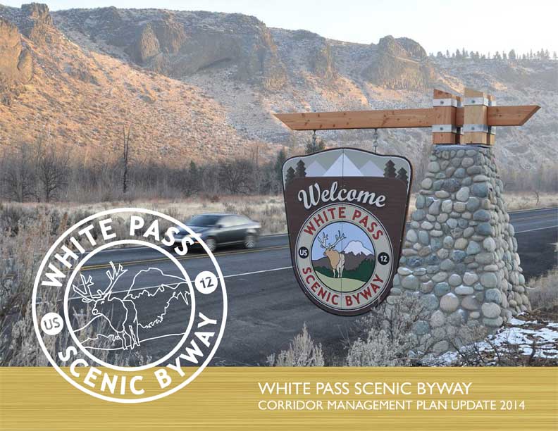
The National Scenic Byway Foundation announced on October 16, 2009, a new national designation for the White Pass Scenic Byway. Collectively, there are 193 such designations in the United States and only seven in Washington, including Chinook Pass Byway, Coulee Corridor Scenic Byway, International Selkirk Loop, Mountain to Sound Greenway (I-90), Stevens Pass, and the Strait of Juan de Fuca. View the press release.


An outreach program has been developed and is underway to train retail and services staff along the byway corridor to provide effective travel information. The program encourages local staff, from visitor center staffers to gas station clerks, to consistently provide friendly hospitality and accurate information for visitors. The program is conducted in a series of free workshops in communities along the byway each spring to encourage local staff, from visitor center staffers to gas station clerks, to provide friendly hospitality and accurate information for visitors consistently.
The recreation driving tour project provides travelers with information about forest recreation driving opportunities accessible from the byway. Wayfinding signage was installed alongside trip routes adjacent to the byway in the Gifford Pinchot and Okanogan-Wenatchee National Forests to help visitors find scenic routes off the byway. This signage corresponds to the driving tours listed on our tearsheet maps.

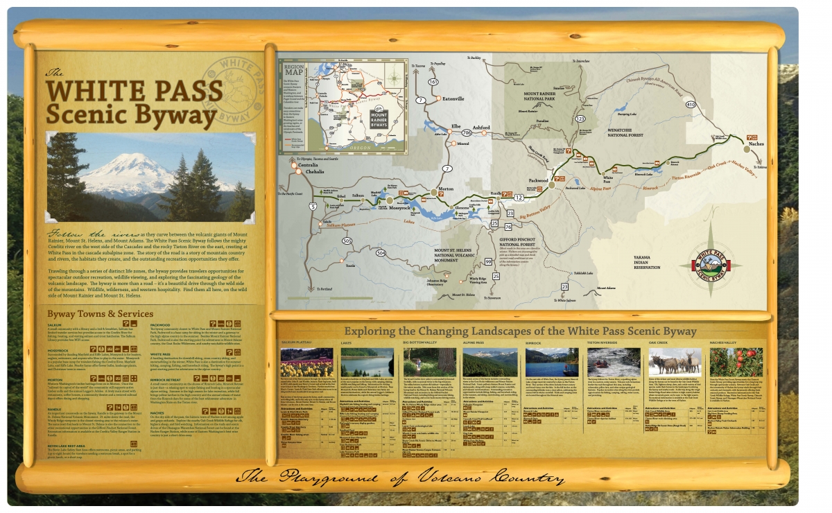
Tearsheet maps were created as handouts to educate travelers and residents on the variety of historical, scenic, natural, and cultural experiences along the byway. The map provides a detailed look at points of interest and services in the area, helping to orient the traveler. The flip side of the map features eight detailed itineraries outlining side trips off the byway. Download the tearsheet map.
The Byway has produced a rack card with information, including a brief description of the Byway and a list of what to do and areas to visit along the corridor. This activity works to educate travelers on the significance of the byway’s natural, cultural, scenic, and historical resources. View marketing grant press release.

Ten interpretive map panels were created and installed in ten communities along the White Pass Scenic Byway. The panels provide information on the communities, points of interest, services, and changing landscapes along the Byway. This project was intended to improve way-finding and travel information along the Byway. View the interpretive map panel.
The plan focuses on strategies to enhance the Byway while conserving its natural resources. Enhancements will provide more opportunities for recreation and tourism, strengthening the local economy while conserving the Byway’s unique resources. View the press release.
Questions or Comments? Drop us a note we’d love to hear from you.